Taxi Worton North Yorkshire
The Herriot Way is named of course after James Herriot who moved to the area in the late 1930s to start a veterinary practice. The rest as they say is history. His books became particularly popular in the 1970s, when Herriot discovered that there was no end to the average animal lovers desire for his incidental and sentimental anecdotes. By the late 70s - mid 80s this interest spawned a film and a very successful TV series based on his life. This walk visits a lot of the places where he lived and worked.
This circular walking tour was originally designed in 4 stages to make use of the Youth Hostel accommodation at Aysgarth, Grinton, Keld and Hawes. However there is plenty of conventional accommodation both in these 4 villages and in the intervening settlements along and close to the way. The conventional way to walk the Herriot Way is anti clockwise, starting and finishing at Aysgarth Falls. However there is no golden rule which states that the tour has to be walked in this direction, There are some advantages in doing the walk in a clockwise direction, not least that you can make use of the Sherpa Van service to move your baggage on each day. This service is not available for those doing the tour anti clockwise.
Planning your day stages
The Herriot Way falls conveniently into 4 stages averaging 13 miles each, stopping overnight at:
(1) Aysgarth, (2) Hawes or one of the hamlets in its vicinity (3) Keld or Thwaite or Muker, (4) Grinton or Reeth and (5) Aysgarth again or Carperby.
Over this sort of terrain days of this length can be regarded as moderate for a fit walker, but it is quite feasible to add in one or even two extra stages using accommodation at intermediate points, such as Askrigg, Bainbridge, Healaugh or Castle Bolton. Also there is no rule which states that the tour has to start at Aysgarth. Grinton or Hawes would also make good starting points, with public transport connections no worse than those to and from Aysgarth. Keld however is more remote and less accessible.
Typical Itinerary
Stage 1: Aysgarth to Hawes (13 miles).
There is a lot to see on this stage, and if you are starting the tour in Aysgarth and don't want to rush things you could spend a night in Askrigg or Bainbridge. This might make the two first days rather short for most walkers, you could however take time to explore Bainbridge and its surroundings (milepost 6) . You start by following the banks of the River Ure past the Upper Fall and then from Worton Bridge (milepost 4) climb up the north side of the dale to Askrigg (milepost 5). You continue at a high level on the north side of the dale passing several farms and hamlets and surmounting numerous stiles before reaching Hardraw Force waterfall. From there it is only a couple of miles across the valley to the stage end at Hawes.
Stage 2: Hawes (or nearby hamlets) to Keld (or Thwaite or Muker) 13 miles.
The Herriot Way crosses the Pennine Way at Hawes and before rejoining it for the crossing of Great Shunner Fell the trail passes through Appersett. Beyond Appersett the Herriot Way combines with the Pennine Way and follows the long curving ridge which leads to the summit of Great Shunner Fell (716m) the highest point on the tour. You then descend north-eastwards to Thwaite, your first hamlet in Swaledale. Beyond Thwaite you pass close to the pretty village of Muker before parting from the Pennine Way to climbing over Kisdon Hill (499m) and descend to Keld. In conditions of heavy rain or poor visibility it is possible (and may be advisable if your map and compass skills are not good) to take an easier route following a narrow tarmac road over the moorlands from Appersett via Hardraw to Thwaite, and then another relatively quiet tarmac road from Thwaite to Keld. You will need to carry a picnic today; the only places of refreshment en route after leaving Hawes are at Thwaite, where you may be able to get afternoon tea, and at Keld, where there is a small cafe open seasonally. There is a pub and a shop at Muker which is a short distance off the route.
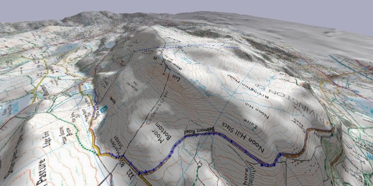
Stage 3: Keld (or Thwaite or Muker) to Grinton (14 miles) (or Reeth).
With minor differences this stage coincides with Stage G of the well-known Coast-to-Coast walk originated by Alfred Wainwright (also served by the Sherpa Van baggage transfer and accommodation booking service). The original Wainwright route keeps to the high ground, passing the evocative remains of former lead mining operations on the desolate moorlands around the head of the Gunnerside Gill and at Old Gang Mine. Starting from Keld you pass the Kisdon Force waterfall before climbing past the ruined Crackpot Hall (milepost 27.5) onto the high moorland. An interesting spot for lunch on the high level route is by the old mine buildings at Blakethwaite on the Gunnerside Gill (milepost 30). There is no phone on the high level route between Keld and Reeth. There is an alternative low level route which follows the River Swale which is better in bad weather, however many walkers prefer this pretty route anyway, as there are pubs available to stop for lunch.
Stage 4: Grinton to Aysgarth Falls (12 miles).
From Grinton you climb south-westwards out of Swaledale along miners' tracks across Harkerside Moor, passing old lead mine workings...
Share this article
Related Posts


Latest Posts


